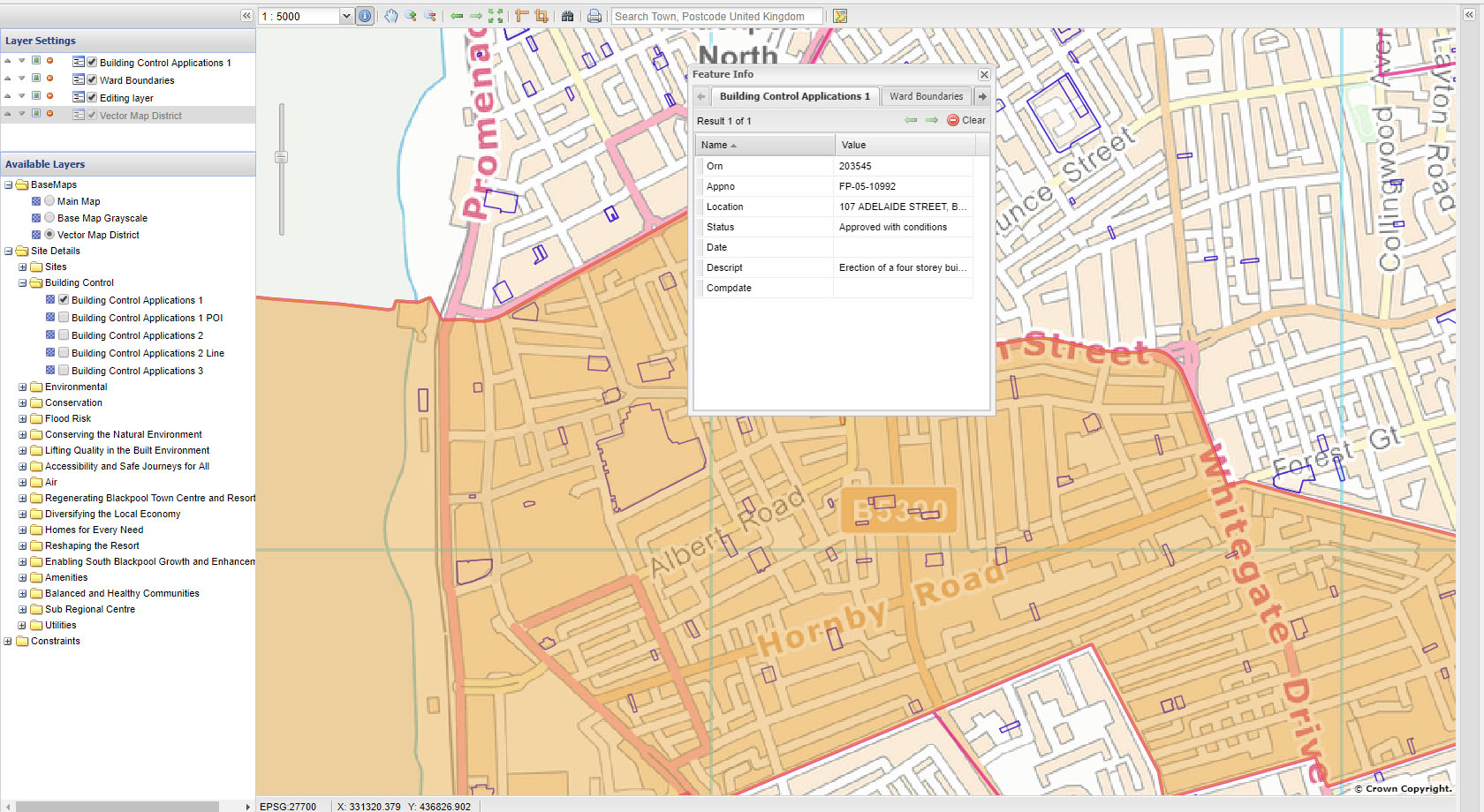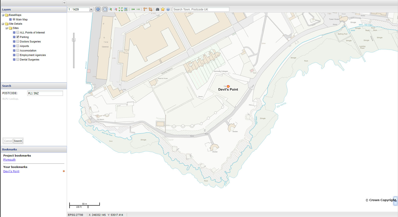

GGP web mapping products (intranet and Internet) are Open Standards solutions. They have been written from the ground up – at their foundation are GeoServer and MapServer – Open Source platforms onto which we have built a user friendly, “front end” interface which, when coupled to a spatial database, will provide a flexible and adaptable platform to deliver web mapping to staff and the general public. The net result is a crisp, modern user interface that is very responsive providing the following key benefits:
- Fast web mapping for intranet and Internet
- Hosted internally or in the cloud
- Publish layers from GGP desktop, and many common GIS formats
- WMS and WFS feeds
- Modular, allowing functionality to me easily added or removed
- Open standards with cross browser support