


GGP 2009 introduced the ability to create overlays that read and write data stored in geospatial databases: Oracle Locator, SQL Server 2008, PostGIS. We can use this feature to register a layer that will show the MasterMap change-only updates on a map.
To prepare for this demonstration, I have loaded a MasterMap database with an initial load received in December 2009. I subsequently applied the following five COUs:
- From 15/12/2009 to 02/02/2010
- From 02/02/2010 to 16/03/2010
- From 16/03/2010 to 27/04/2010
- From 27/04/2010 to 08/06/2010
- From 08/06/2010 to 20/07/2010
GGP 2009 allows creating overlays that read data from database views in addition to ordinary tables. I took advantage of this, creating a view called VEW_COU_TOPOGRAPHICAREA, which will return only records updated after 15 December 2009 by Ordnance Survey:
SELECT

  FID, FEATURECODE, VERSION, VERSIONDATE, THEME, CALCULATEDAREAVALUE,

  CHANGEDATE, REASONFORCHANGE, DESCRIPTIVEGROUP, DESCRIPTIVETERM,

  MAKE, PHYSICALLEVEL, PHYSICALPRESENCE, POLYGON, LOADDATE, MI_PRINX

FROM

  TOPOGRAPHICAREA

WHERE

  VERSIONDATE >= '2009-12-15 00:00:00'
Using the ATFEdit Setup application, I create an Area overlay labelled “MasterMap Area COU”, which will obtain data from the VEW_COU_TOPOGRAPHICAREA view. Since I am connecting to a SQL Server 2008 database, the layer will be created with the advanced parameter SafeSpatialQueryMode set to “true”. For a large dataset such as MasterMap Topography, this is going to have a significant impact on performance. Since MasterMap is almost guaranteed to be free from invalid geometries that might be hard to handle for SQL Server 2008, I can change the SafeSpatialQueryMode to “false”.
-
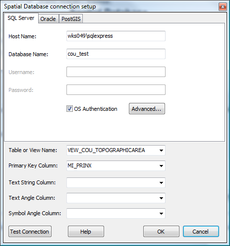
- Overlay Connection Details
-
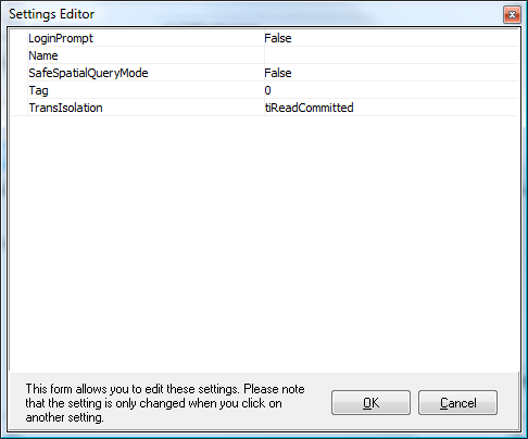
- Advanced Settings for SQL Server 2008
-
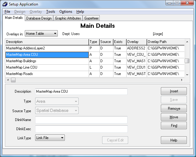
- MasterMap Area COU Layer
We can now add the new overlay to a script, and show the change-only updates on a map:
-
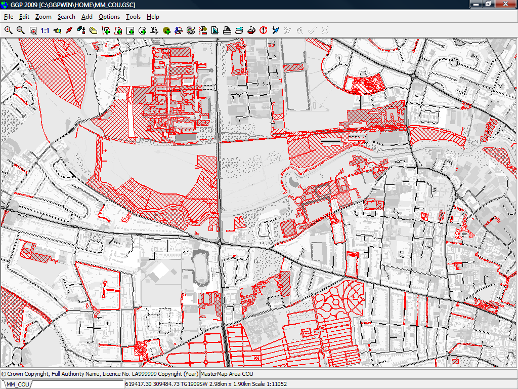
- MasterMap COUs Mapped
-
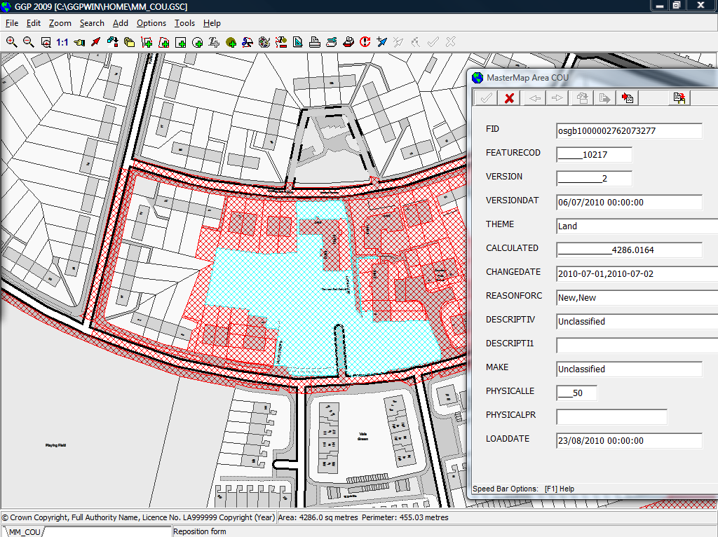
- Individual Feature Detail
(Part 2 of this post available here)
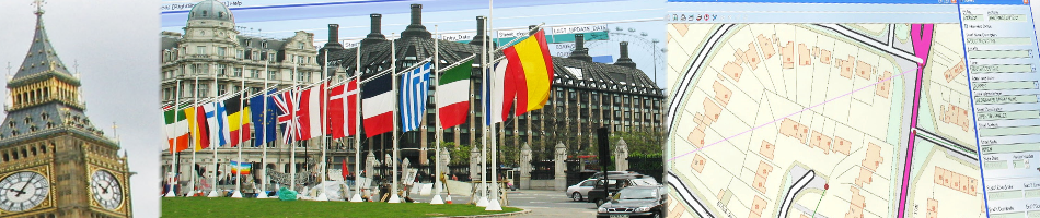
Read more: MasterMap, OrdnanceSurvey