

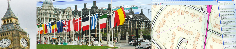


Croydon, 19 June 2015 – GGP Systems has announced the latest version of its Geographic Information Systems (GIS). The new version offers true open systems architecture to provide unrivalled levels of interoperability making it the ideal corporate GIS solution. Able to work with different spatial databases, GGP has designed the latest version, to make it easier to share data with other mapping platforms and interchange with other map datasets.
Working with multiple spatial databases including Oracle 10g/11i/12i, SQL Server 2008/2012 and PostGIS 1.x/2.0, GGP has significantly extended integration capabilities with support for the open source OSGeo Feature Data Objects (FDO). This opens up access to additional data providers including Web Mapping Service (WMS), Web Feature Service (WFS), KML, MapInfo (TAB), ESRI (SHP) and ArcSDE.
The new version builds on a 23 year track record of GIS development by the Croydon based company to meet the needs of UK local authorities. The latest developments make it easier for local authorities to deploy GIS as an enterprise wide solution accessing multiple data sources that can facilitate web based and wireless location based applications.
GGP’s spatial database capability allows information to be freely shared between departments or other organisations. This eliminates data silos, reducing data duplicity and improving system interoperability. To help local authorities reduce IT costs, GGP’s GIS also supports PostgreSQL v2 which is a free, open source platform that offers a proven, stable environment.
“Local authorities now fully appreciate the power of geographic information as a way to coordinate and improve services, boost efficiency and improve decision making. However, getting access to the vast array of potentially valuable data has proved challenging,” says Tim Maxwell, Managing Director of GGP Systems.
“GGP’s GIS not only makes it easy to deploy enterprise wide spatial information but the latest developments open up access to much more useful data held internally and externally. Single point access to multiple datasets allow a much clearer pictures to be built of the local environment and community to improve decision making and facilitate the sharing of data, resources and services,’ explains Maxwell.
Contacts:
Reader enquiries to Aliyah Page-Graham at GGP Systems on tel +44 (0)20 8686 9887
Editorial enquiries, contact Robert Peel on tel +44 (0)1666 823306
Colour separation requests to robert@market-it.co.uk
Notes to Editors:
GGP Systems specialise in GIS and Gazetteer Management solutions specifically designed for the UK public sector. The South London based company provides easy to use software for the creation and management of corporate property databases, the ability to add and use a spatial element to all location based information and a range of solutions to meet both national and international Government directives.