

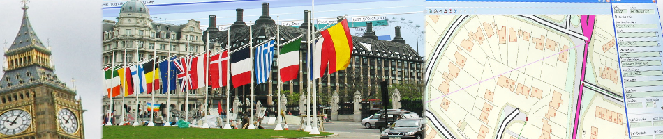


 Croydon, 01 March 2011 – Users of the latest release of GGP Systems’ desktop Geographical Information System (GIS) will be some of the first to comply with the latest EU Directive. Designed to improve access to and knowledge of geographical data holdings the INSPIRE directive requires that member states provide public access to location based data related to the environment.
INSPIRE is part of a suite of European Directives that aim to standardise and ensure access to public data across Europe. The latest release of GGP GIS will allow users to submit information about their spatial data holdings to a publicly accessible, centrally maintained data catalogue.
“With this release GGP users will be amongst the first in the UK to comply with this legislation,” commented GGP Systems Managing Director and founder Tim Maxwell. “As early adopters GGP GIS users will be instrumental in the development of a fundamental shift in the development, management and dissemination of public sector data.”
The data catalogue, GeoNetwork Opensource, harnesses the power of the Internet to enable access to geo-referenced databases, cartographic products and related metadata from a variety of sources. Well in advance of the May 2011 deadline users of GGP GIS Service Release 5 can easily generate metadata (data about data) in Gemini 2.1 format, compliant with ISO 19115 and 19139.
GGP GIS already offers the ability to store complex layers of mapped information in an international standard format defined by the Open Geospatial Consortium (OGC). Being able to directly read from and write to spatial databases means information can be effectively shared between departments and or other organisations, eliminating isolated data silos, reducing data duplicity and improving system interoperability, as well as enabling the joining up of diverse datasets to provide a richer information resource. The storage of geographical data in this format also enables it to be published using WMS (Web Map Service) the international standard for Internet mapping and the preferred format for INSPIRE publication.
GGP Systems specialise in GIS and Gazetteer Management solutions specifically designed for the UK public sector. The South London based company provides easy to use software for the creation and management of corporate property databases, the ability to add and use a spatial element to all location based information and a range of solutions to meet both national and international Government directives.
CONTACTS:
Product sales enquiries Karen Barcoo at GGP tel. +44 (0)20 8686 9887, e-mail: Karen@ggpsystems.co.uk, www.ggpsystems.co.uk
For further editorial information and photos, call Robert Peel on tel. +44 (0)1666 823306
Please fax colour separation requests to fax +44 (0)1666 824668